
Geospatial Technique
Geospatial Techniques for Informed Decision-Making
Unlocking Insights for a Sustainable Future
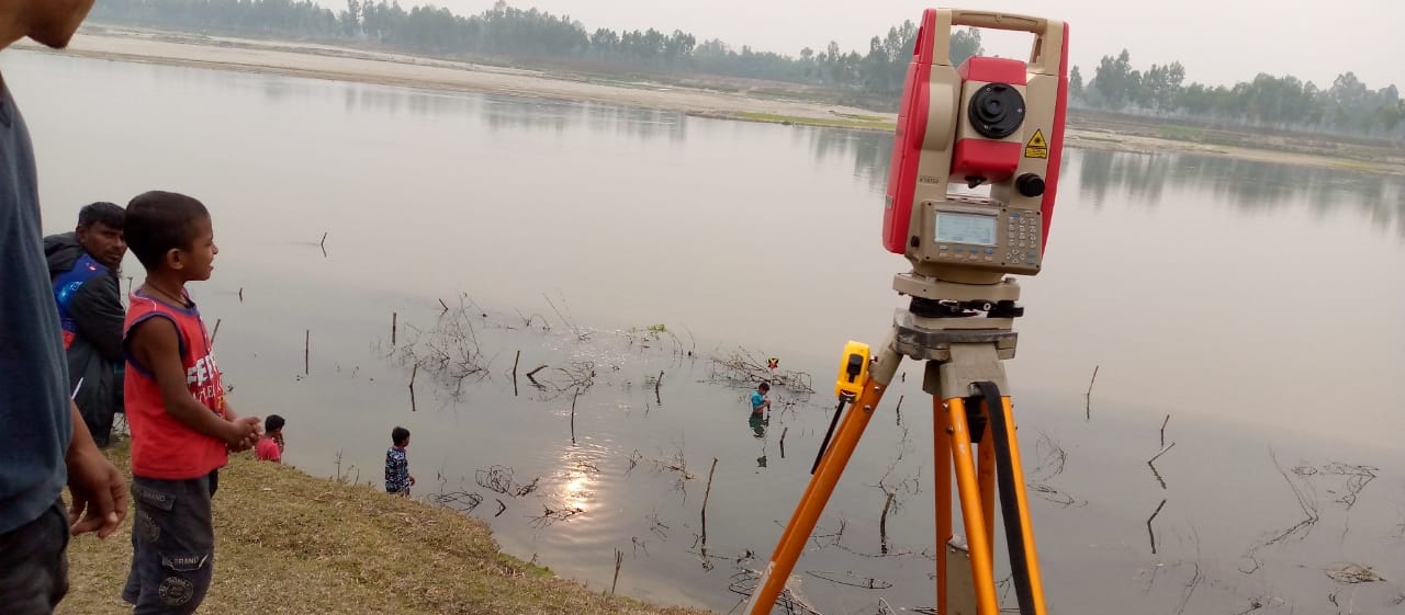
The realm of geospatial techniques has witnessed a transformative revolution in recent times, with a proliferation of spatial data sources and data types at various scales and high temporal frequencies. From optical and active-sensor satellite remote sensing, equipped with altimetry capabilities, to sub-surface groundwater investigations facilitated by the likes of the GRACE satellite, the arsenal of geospatial tools has expanded exponentially. Complementing these capabilities are Geographic Information Systems (GIS) and Global Positioning System (GPS) technologies, as well as state-of-the-art survey instruments such as low and high altitude drones, boasting onboard instruments like LiDAR, Radar, and multispectral sensors.
The Power of Integration
- Harnessing Innovation: When combined with big data, encompassing spatial big data, telco data, and data from Internet of Things (IoT) devices, along with the computational prowess of cloud computing delivered via internet and mobile networking services, geospatial techniques open up boundless opportunities for understanding facts and phenomena in innovative and unprecedented ways.
- Insights for Climate Change: These data sources, methods, and tools have proven to be indispensable in acquiring in-depth, detailed knowledge and understanding of climate change impact conditions. Moreover, they facilitate the design of adaptive pathways, including low carbon and green development strategies.
A Call for Data Updating
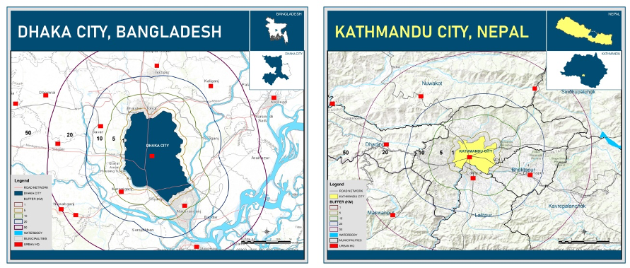
- The Relevance Imperative: Developing nations like Bangladesh find themselves at a critical juncture where the adoption of these new technologies is paramount. The imperative to update outdated databases, which have lost relevance in many ways, has never been more pressing.
Our Geospatial Expertise
- Seasoned Professionals: At Science Connect, we house a team of trained professionals who possess a wealth of experience in leveraging geospatial data to tackle a wide array of challenges.
- Technology Transfer and Capacity Development: We have a proven track record of facilitating technology transfer and building capacity, empowering organizations and individuals to harness these cutting-edge tools effectively.
Join Us in Shaping a Data-Driven Future
Science Connect extends an invitation to join us on a journey of exploration and innovation. Explore the myriad possibilities offered by geospatial techniques and the transformative potential of big data. Be part of our mission to unlock insights that drive informed decision-making and contribute to a sustainable future. [Discover Our Geospatial Services]


Become Our Partner
There are various ways you can contribute to our goal, whether you want to join our team, form a partnership, or contribute to our purpose. Go to contact