
Hydro-morphological study and bathymetric survey
Innovative Analysis Using RS-GIS Technology
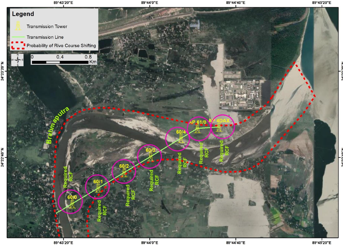
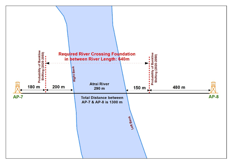
🌊 Advanced Morphological Studies we specialize in conducting comprehensive studies on river, delta, and coastal morphologies. Utilizing a unique method based on Remote Sensing and Geographic Information System (RS-GIS) technology, we integrate spatial and hydro-morphological information. This approach allows us to accurately predict and monitor morphological changes and riverbank erosion, essential for environmental management and infrastructure planning.
Our Specialized Services
- Morphological Change Prediction
- Predictive Analysis: Using GIS technology to forecast future changes in river and coastal landscapes.
- Erosion Monitoring: Identifying potential areas of bank erosion and proposing preventive measures.
- Morphological and Planform Analysis
- Comprehensive Evaluation: Assessing the shape and form of rivers and coasts to understand their evolving dynamics.
- Impact Assessment: Studying the implications of these changes on surrounding environments and communities.
- Dredging Optimization
- Navigation Maintenance: Developing strategies for dredging that ensure the navigability of major rivers without disrupting ecological balance.
Why Our Services Matter
- Environmental Protection: Our studies aid in safeguarding river and coastal ecosystems.
- Infrastructure Safety: Predictive analyses help in planning and protecting infrastructure against natural changes.
- Sustainable Management: Ensuring the ecological balance while maintaining human activities like navigation.
Contact Us for Consultation
- If you require expert analysis and strategies for river and coastal management, we are here to help.
Become Our Partner
There are various ways you can contribute to our goal, whether you want to join our team, form a partnership, or contribute to our purpose. Go to contact