
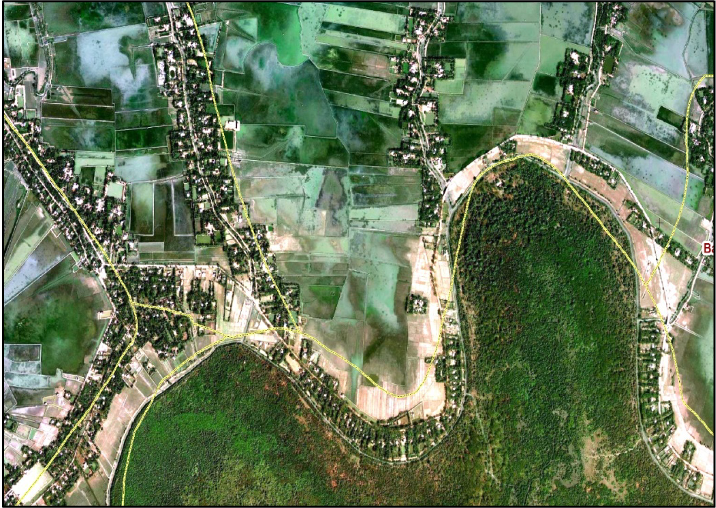
Topographic survey using Total Stations, RTK, Drones and archived spot heights
Topographic Survey Services
Precision Mapping with Advanced Technology
Survey Process
- Total Stations
Pinpoint Accuracy: Ideal for capturing precise distance and angle measurements, especially beneficial in construction, landscaping, and architectural projects.
Application: Utilized for detailed site planning, boundary delineation, and structural measurements.
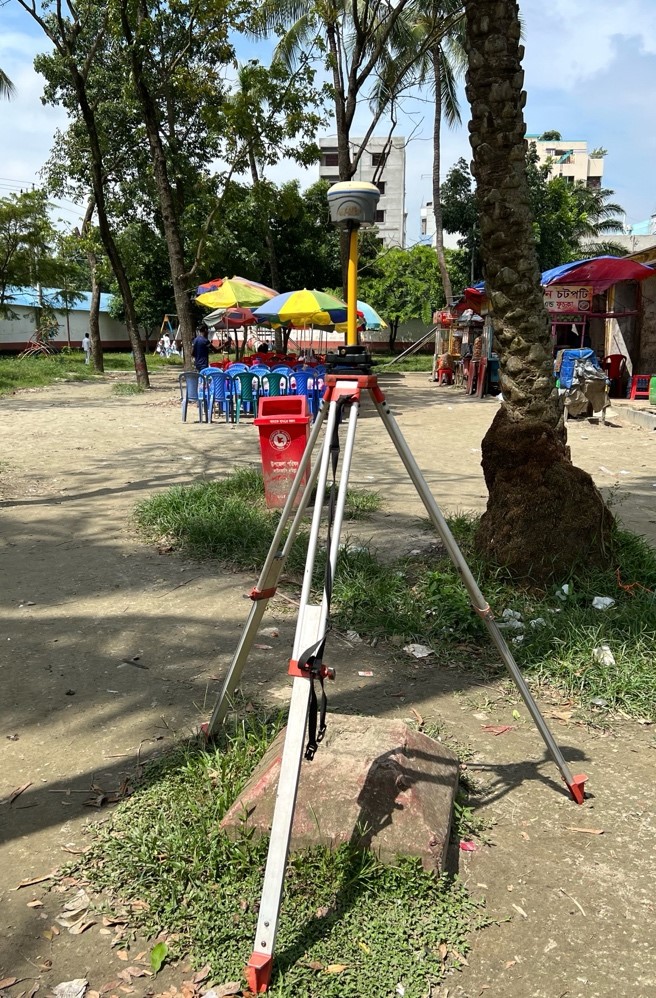
- Real-Time Kinematic (RTK)
Satellite Precision: Offers centimeter-level accuracy by correcting GPS signals, crucial for large-scale land development and agricultural planning.
Speed and Efficiency: Rapid data collection speeds up the survey process, allowing for timely project execution.
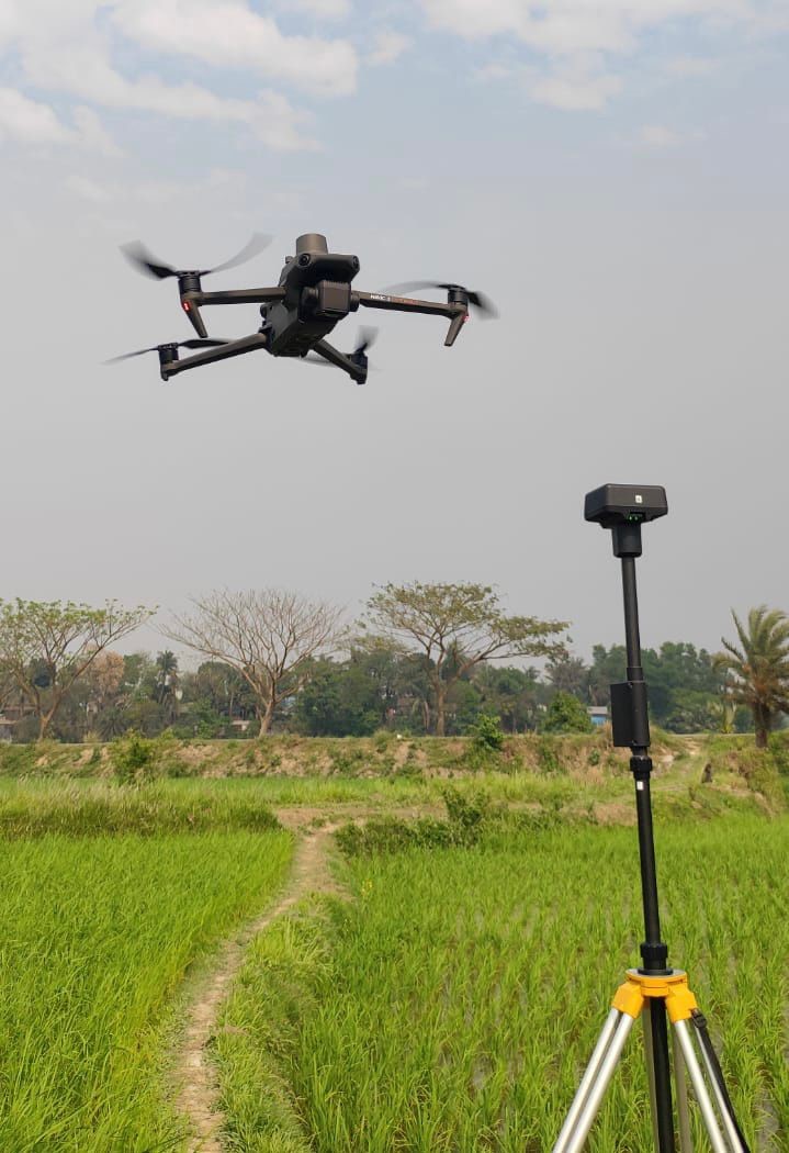
- Drone Surveys
Broad Coverage: Provides an expansive overview of large or difficult-to-access areas, perfect for environmental impact assessments and urban planning.
Versatile Imaging: Capable of capturing high-resolution photographs and 3D terrain models, aiding in detailed analysis and visualization.
- Archived Spot Heights
Historical Context: Integrates past terrain data, ensuring a comprehensive understanding of land changes over time.
Enhanced Accuracy: Augments current survey data, offering a richer, more nuanced topographical picture.
Why Our Topographic Surveys Stand Out
Technology Integration: We combine various high-tech surveying methods for results that are both accurate and comprehensive.
Customized Solutions: Every survey is tailored to the specific needs and objectives of your project.
Experienced Team: Our skilled surveyors are adept at leveraging these technologies to deliver precise and reliable data.
Project Inquiry and Contact
For detailed topographic surveys that offer precision and clarity, reach out to us. Let’s discuss how we can tailor our surveying solutions to your project’s needs
Become Our Partner
There are various ways you can contribute to our goal, whether you want to join our team, form a partnership, or contribute to our purpose. Go to contact